Precision | Safety | Innovation
Geotechnical and Structural Monitoring

RE-MONITOR is a US company belonging to the NHAZCA Group, Rome, Italy.
RE-MONITOR, established in the United States as a subsidiary of NHAZCA S.r.l., brings state-of-the-art monitoring solutions to the North American market. Our core mission is to transform remote sensing practices by integrating advanced technologies, including Satellite and Terrestrial InSAR, and our proprietary Photomonitoring system, to address the growing need for reliable, scalable, and effective monitoring.
Mission
To provide data-driven insights and state-of-the-art tools that empower asset owners, engineers, and decision makers to identify risks early, mitigate hazards effectively, and ensure long term resilience. By combining NHAZCA’s expertise with a team of leading American professionals, we bridge decades of knowledge and cutting-edge technology to deliver monitoring excellence.
Vision
To be a global leader in monitoring and managing territories and infrastructures, revolutionizing the use of remote sensing technologies to create a safer and more sustainable future.
Purpose
To make the world a safer place by trasforming data into actionable insights to prevent risks and manage environmental and infrastuctural complexities.
Cutting Edge Solutions for the future of monitoring
RE-MONITOR is a cutting-edge company specializing in the assessment and monitoring of geological and infrastructural risks. With a team of experts holding strong backgrounds in engineering, geology, and remote sensing technologies, we develop innovative solutions for controlling and managing territories and infrastructures, ensuring a positive impact on the society and the environment.
RE-Monitor: Exclusive North American Partner of NHAZCA Technologies

RE-MONITOR proudly serves as the exclusive subsidiary in North America for NHAZCA, a global leader in advanced geohazard assessment and monitoring solutions. This strategic partnership brings NHAZCA’s cutting-edge technologies—pioneered in Europe and globally recognized for their precision and innovation—to the North American market, ensuring unparalleled expertise in monitoring natural and built environments.
With RE-MONITOR, North America gains direct access to NHAZCA’s state-of-the-art solutions, empowering businesses and communities to achieve safety, resilience, and sustainability through world-class monitoring systems.
At RE-MONITOR, innovation and sustainability converge to tackle today’s challenges and build a better tomorrow.
We are a fast-growing company supported by robust academic and industrial partnerships, enabling continuous innovation and the delivery of advanced services to meet the demands of the global market.
PhotoMonitoring™

PhotoMonitoring™: Innovation in Land and Structural Monitoring
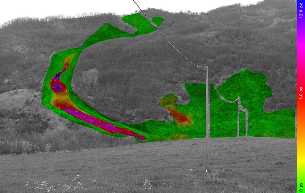
PhotoMonitoring™ is an advanced method for analyzing and quantifying changes and movements in terrain and structures through image processing algorithms. Using optical, infrared, or radar data acquired from platforms such as cameras, drones, satellites, and aircraft, this technique enables multiscale and multitemporal monitoring. Ideal for applications such as natural hazards (landslides, sinkholes, glaciers), infrastructure (highways, rail, dams, viaducts, buildings), and mining, it delivers millimeter-level precision, real-time analysis, and full automation through the IRIS software developed by NHAZCA.
Versatile | optimizing multiple platforms
Low cost monitoring past | future
Minimal field maintenance
Sub-mm accuracy
Portable & Quick to install
Terrestrial SAR Interferometry

Terrestrial Interferometric SAR (InSAR)
The terrestrial interferometric SAR (InSAR) technology offered by RE-Monitor represents a groundbreaking advancement in geotechnical and structural monitoring.
Through an innovative technique, the system compares radar signals emitted by the antenna with those reflected by objects within the observation area
| Benefit | Description |
|---|---|
| High-Frequency Data Sampling | Continuous data collection for comprehensive monitoring. |
| Non-Invasive Deployment | No need for reflectors or physical modifications. |
Satellite Interferometric SAR (InSAR)

Satellite Interferometric SAR (InSAR)
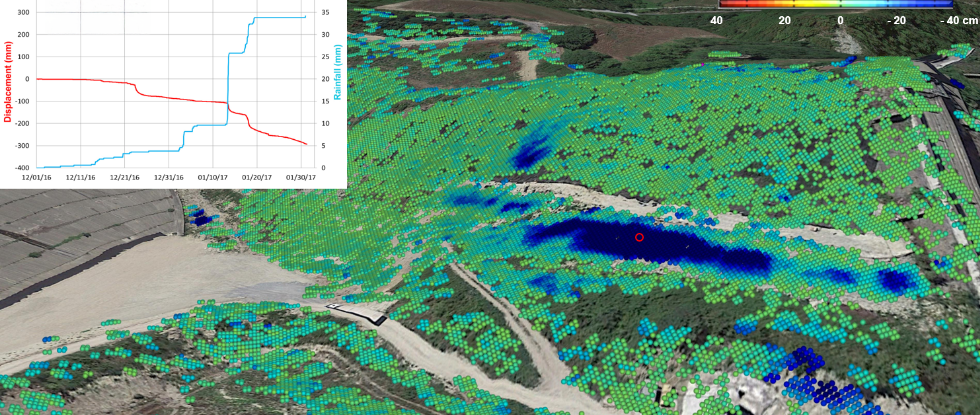
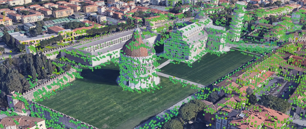
Satellite Interferometric SAR (InSAR) enables remote monitoring of ground and structural deformations with millimetric precision over large areas. RE-Monitor develops innovative technologies for customized applications, utilizing advanced algorithms to assess slope stability, subsidence, infrastructures, and natural phenomena such as volcanoes and earthquakes.
Advanced tools like the InSAR Visualization Tool, and the PS ToolBox provide detailed analysis and seamless data integration.
Remote monitoring with mm accuracy
Retrospective monitoring 1990+
Wide area, all-weather operation
No field maintenance
Value for our customers

Engineering Firms
Engineering Firms Enhance project design and management with cutting-edge monitoring tools.

Construction, Mining, and Oil & Gas Companies
Overcome challenges in complex geotechnical and geological conditions with real-time data and actionable insights.

Government Agencies
Optimize asset management and hazard prevention for roads, railways, and other public infrastructure.
RE-MONITOR is committed to revolutionizing the present
to build a safer and more sustainable future

RE-volutionizing
We transform geotechnical and structural monitoring with cutting edge technologies which redefine the standards of precision and reliability

RE-shaping
We are transforming the future of terrestrial monitoring to help ensure the safety of infrastructures and the built environment

RE-inventing
We innovate the way by which data is acquired and analyzed, combining flexibility and accuracy with bespoke solutions

REmote Sensing
Using advanced systems such as InSAR and PhotoMonitoring we deliver timely and high-resolution surveillance of geological and critical assets


